Scientists discover evidence that large and deep rivers flowed through Mars billions of years ago
05/08/2020 / By Arsenio Toledo

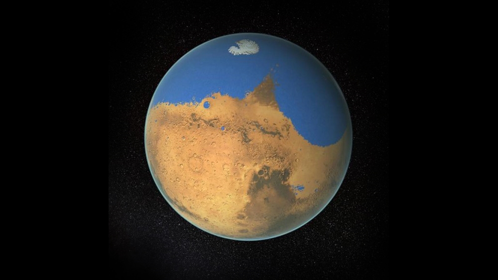
Astronomers from the University of Utrecht (UU) in the Netherlands looked at high resolution images of Mars gathered from orbiters and uncovered evidence that the red planet once had a river that flowed across its surface for more than 100,000 years. They believe that the rivers “continuously shifted their gullies, creating sandbanks, similar to the Rhine or the rivers that you can find in Northern Italy.”
“It is not like reading a newspaper, but the extremely high resolution imagery allowed us to ‘read’ the rocks as if you are standing very close to the cliff,” said study author and geologist Francesco Salese.
Salese and a team of international researchers used imagery captured by NASA’s Mars Reconnaissance Orbiter using a High Resolution Imaging Science Experiment (HiRISE) camera. Their findings were published in the journal Nature Communications.
Ancient Martian rivers were around 10 feet deep
The images Salese and his team gathered were from the rim of the Hellas Basin, an extremely large impact crater that has interested researchers for so long because of its size. It stretches 5.6 miles from the floor of the crater to the rim. In this area of Mars, the researchers found ancient evidence of large lakes, rivers, channels and deltas. From their analysis, they suggest that Mars must have sustained a significantly large amount of water in the past. (Related: NASA’s Mars orbiter takes a breathtaking photo of a 50-foot crater; impact could have occurred between 2016 to 2019, say experts.)
Salese and his team focused on a rocky cliff, about 656 feet from the floor of the crater. Here, they found that the markings on the rocks were similar to those seen on Earth when water flows through areas for significant periods of time. The scientists further estimated that the rocks were at least 3.7 billion years old.
Due to this age, Salese and his team are unable to predict the approximate length of the river. Erosion, they say, has made Mars’ surface vastly different from the one that existed when the river had water around three billion years ago.
However, Salese and his team estimated that the rivers that flowed through the Hellas Basin were around 10 feet deep and that they were constantly shifting, creating sandbanks similar to many prominent rivers on Earth, such as the Rhine in central Europe.
These rivers, Salese argued, would have required an environment that was capable of sustaining extremely large volumes of water for long periods of time. This means that the water on Mars would have to be driven by its own water cycle.
“This kind of evidence, of a long-lived watery landscape, is crucial in our search for ancient life on the planet,” said Salese.
Technology used to examine Mars can be used for future studies
Geologists on Earth have long used the order and positioning of rocks to trace the history of ancient rivers and water systems. According to William McMahon, a geologist at UU, this methodology can now be extended to Mars and to other planets thanks to the advanced technology that helps scientists capture high-resolution imagery.
He is particularly excited about future studies on Mars, which he says contains an “ancient sedimentary rock record” that extends further back in time than Earth’s own.
Salese’s research is supported by previous studies that have also suggested that liquid water existed on the surface of Mars for long periods of time. Salese regrets that, while the high-resolution pictures from the HiRISE camera have helped them understand so much of the surface, they “don’t have the ability to climb, to look at the finer-scale details.”
But with the advancement of technology, there’s hope that future studies will be able to give people a better understanding of the presence of water on Mars.
Sources include:
Tagged Under: breakthrough, cosmic, discoveries, future science, lakes, Mars, Martian rivers, NASA, research, rivers, science and technology, Space, water on Mars
RECENT NEWS & ARTICLES
COPYRIGHT © 2017 FUTURE SCIENCE NEWS


